Deception Pass State Park is one of the most used state parks in Washington. The park is on both sides of the narrow body of water between Fidalgo Island and Whidbey Island. It’s about an hour’s drive north of Seattle. Last week I shared about the north side of the park. Today we will look at Pass Island and the south side of the park.
Let’s start with the bridges that cross over Deception Pass. The two bridges are high above the water and offer scenic views in all directions. For many people a walk out onto the bridges is their major experience at Deception Pass. There is parking at both ends of the bridges. However, on the Whidbey Island side, the parking lot charges $10 or requires a Discover Pass. It can also be hard to find a parking spot there, especially on a busy weekend, as it’s fairly small. The Fidalgo Island side is a more informal parking area. There is no charge to park there, but parking is also limited.
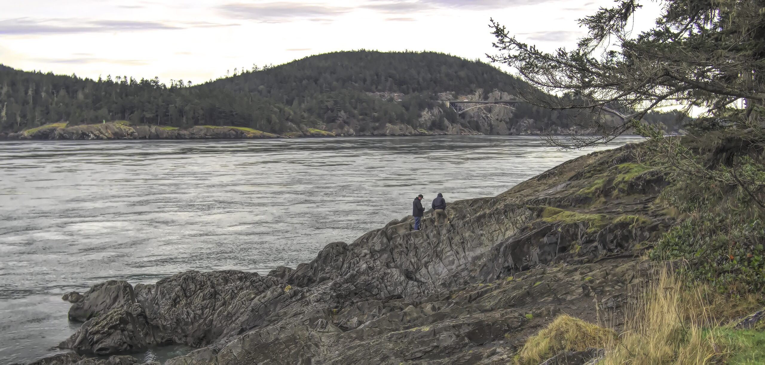
As visitors walk out onto the bridge, they will come to Pass Island, the small island that lies in the middle of Deception Pass. There are stairs here on both sides of the bridge that lead down to the island itself. Here visitors can explore around the island or just cross under the bridge to check out the view from the other side. There are trails around the island so there are a number of viewpoints to capture here.


The main entrance to the south side of Deception Pass State Park is actually a ways from the bridge. The entrance is on the west side of the highway. This section of the park offers camping spaces as well as a variety of recreational activities. Even on a winter day in January, we found the area busy with visitors hiking and enjoying the beach.
The road to the beach parking lot will travel around Cranberry Lake. This is a freshwater lake. We saw some people fishing there along the shore. It also appears to be a swimming area in the summer time and has a number of picnic tables near it.


At the end of Cranberry Lake is a large parking lot on the beach. Again parking will be $10 or a yearly Discover Pass. From this spot there are a number of options. Visitors can walk along the western beach, hike along Deception Pass back to the bridge, or just enjoy the beach right there by the parking lot.
The walk toward West Beach is a paved path that eventually leads out to the beach. From here one can see the Olympic Mountains across Puget Sound. This is a fairly pebbly beach. If there are family members who love to collect and find rocks of various shapes and colors, this is a good beach for them. There is sand on the beach, but the pebbles will be strewn around in various pockets. Rock skipping was also popular here.


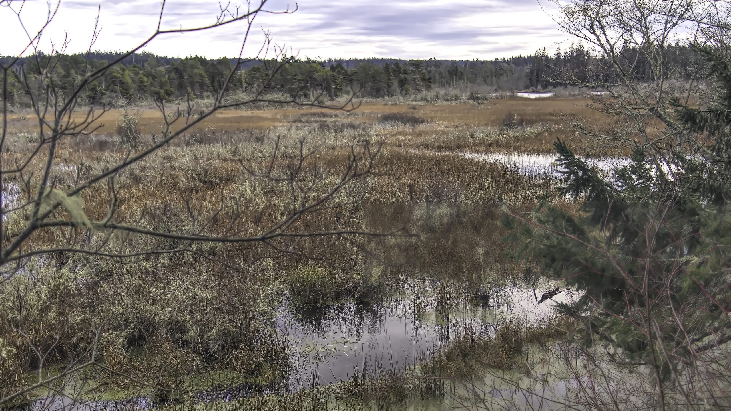
If one wishes to follow the trail around to the east, it will lead to a viewpoint of the Cranberry Lake wetlands and a walk through an area of tall trees. I would think this would be a nice shady walk on a summer’s day. The trail leads back to the swimming area at Cranberry Lake.

The trail along Deception Pass is not right along the beach. If you walk close to the edge here, you will eventually have to turn back. However, following the trail away from the shoreline will eventually lead to a number of beaches along Deception Pass and to the bridge itself.


The trail eventually crosses under the bridge and travels around the park on the east side of the bridge. On our visit, I didn’t realize the trails connected. I wanted to explore the east side so thought I could find a parking area on that side. There isn’t any. There is a road that goes along the southern edge of the park. The first entrance leads to a camping area. I drove through that, and even in winter there were a number of both tent and RV campers in the site but no general parking. Further on there is an entrance to a retreat center. That’s it.
So I learned that to get to the trails on the east side, one either hikes from the parking area near the West Beach or parks at the small parking lot on the Whidbey Island side of the bridge. We did the latter and fortunately found a parking spot.
Walking down the steps to the trail and under the bridge led us to the Goose Rock Perimeter trail which travels around the edge of this part of the park. The unfortunate thing is that it is a bit away from the edge, and trees block the view of the water, at least from a photographic perspective. The water is visible between the trees, but not the best view for pictures. We did finally reach a break in the trees, and there was a great view of the mountains of the North Cascades.


The trail winds around the east edge of the park and eventually leads to a fork in the trail. Staying left, we walked a short distance farther and found some nice views of the Cascade Mountains again looking north and the Deception Pass Marina across the bay to the south.
We returned to the trail fork and took the right trail. This trail began climbing upwards giving us great views of Cornet Bay below us. The problem was the trail began to narrow, and it seemed less traveled. We began to worry that we should have just gone back the way we came although our Google map showed a trail. Eventually we encountered a young hiker coming the other way who assured us the trail would lead us back towards the bridge. Unfortunately we didn’t realize what that would require.


We finally reached the turn that would lead us to the top of Goose Rock Mountain. The trail remained narrow, and now it turned steep, very steep. It was quite a hike up to the top of the mountain, and we certainly got our exercise in on that hike. Let’s just say it was breathtaking.
From the top we could see for quite a distance, and the views included seeing the Olympic Mountains again. It was definitely worth climbing to the top to see. Going down the other side, the trail was wider and much easier to walk. For anyone wanting to hike to see the view from the top, I would advise hiking up this side of the mountain. There are signs pointing the way from the perimeter trail.


Our exploration of Deception Pass State Park took two different days. With plenty of camping available and a variety of things to do, this is a worthwhile place to spend a weekend even in the winter. The scenery is beautiful, yet there are plenty of amenities just a few miles away. No wonder Deception Pass is such a popular state park.
The winter months can be difficult to enjoy outside, but during our pandemic finding outdoor activities to experience can be so important for our health. Are there lowland hikes or walks that you have enjoyed this winter where you live? I’d love to hear about them in the comment section below.
Discover more from Battered Suitcase
Subscribe to get the latest posts sent to your email.