Saturday started out with blue skies over the Monterey Peninsula, and it stayed that way. We finally had a day with no rain and only occasional wind. That was great as today we would head south to the area known as Big Sur. I have often heard of this region, but I had never visited. With Andrea driving, the three of us took off in the morning to explore.
Andrea told us there were a lot of places to stop along Highway 1, and we would not be stopping at all of them. We could see that we were not the only ones taking advantage of the weather as in some places parking was nearly impossible.
The first place we stopped was Garrapata State Park. Really we just pulled over off the side of the road. There were a few trails one could follow down to the edge of the cliffs. The views of the water and the cliffs were amazing. Unfortunately taking photos looking south was a challenge due to the sunlight reflecting off the water.


We continued driving eventually coming to an old bridge, the Rocky Creek Bridge. The bridge was a very popular sight indicated by the traffic. Cars were trying to pull out and turn around on the highway blocking traffic. It was ridiculous. Andrea asked if I wanted to stop, and I said we’d try on the way back.
We crossed the bridge, and the road went up high. We stopped at a viewpoint there which gave great views of the water. I could also see the bridge, but only partially.


Continuing on we made a couple of stops along the side of the road to see the views of the coastline, the waves, and the rocks. The views were much like we saw yesterday at Pebble Beach although we were farther from the water so the wave action was less spectacular.


We had decided that we would drive to the end and then do some hikes on our return. Because of some storms last fall, Highway 1 was closed in the southern part of Big Sur. We knew we couldn’t go too far.
Andrea’s goal was to reach McWay Falls. She has always liked waterfalls so she wanted to hike a short trail there. When we reached the park, we discovered the trail was closed for some construction work. We could still see the falls from the roadway, but no hiking. The waterfall was a narrow stream of water that came out of the rocks. It was a bit underwhelming. (Can you see it in the second picture below?) It was also in shadow making photos challenging. The view north along the coast was more interesting.


The first place we stopped as we started back north through Big Sur was Partington Cove. This was a little intimidating as it was a fairly steep trail down, and I knew we would have to climb back up. However the trail was nice and wide so we went for it. We hiked to near the bottom where the trail took off in an unexpected direction and through a wooden tunnel. On the other side of the tunnel, the trail followed the edge of the water to a point.


There were a lot of rocks in this area, and a number of people enjoying the views. However the main attraction was the dolphins jumping in the water. They would disappear and then jump out of the water again. We weren’t sure how many there were, but there were at least three. Trying to get a photo was tricky. I hadn’t brought my telephoto lens. I only ended up with one shot with a clear dolphin view. (the third photo below)
After watching the dolphins for a while, we started back. The climb up really wasn’t too bad. My motto is always go slow and steady when climbing up, and that usually works for me.


After another viewpoint stop, we came to our next planned stop in Big Sur, Andrew Molerá State Park. This stop turned out to be a bust. First, we were supposed to pay $10 to park, but we didn’t have the cash to do that. There was a mile hike we planned to take, however we got about a tenth of a mile in and came to a river with no bridge over it. That ended that. We were glad we didn’t pay the $10 at that point as our time there was quite short.


We eventually arrived back at the historic Rocky Creek Bridge. If anything the traffic was worse this time, but we managed to get a parking spot pretty easily so we got out. I really don’t know why this is such a popular spot. The bridge is interesting, but it’s not particularly dramatic. Nevertheless people were all over taking photos. It makes me wonder if it has become popular due to some online influencers.


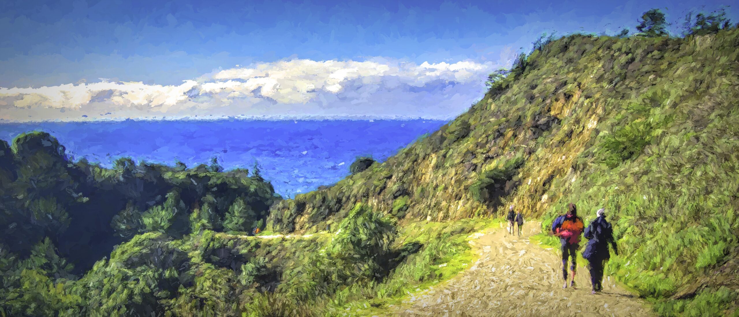
We continued on driving through Big Sur and noticed some people high on a hillside. We stopped to check it out. It turns out it was the same park we had stopped at in the beginning of the day, Garrapata State Park, but a different section. When we got to the trailhead, we could go up or down. I know my wife; we went up. It really wasn’t very far up, and stairs were cut into the trail so it wasn’t too difficult. From up above we had some nice views.


We could see the other trail so when we came down, we followed it. This trail went around the hill over to the rocky cliffs. There wasn’t much of a beach in this area. However the rocks were pretty interesting. On the north side of the hill there was a bit of beach, but we didn’t try to access it. Overall it was a nice looking area and great for photographs.


After our hike we returned to Monterey where we got a light dinner and then settled in for the night just as the sun was setting. The next morning we packed up and began our drive to San Jose’s airport. However, we did stop at one more beach before heading inland. Rio del Mar State Beach is more of a flat, sandy walking beach. My favorite part were the birds who were scurrying around. They would be right at the surf’s edge, and the whole group would scurry away as the waves came in.


After a nice relaxing walk it was time to say goodby to the water. We drove the final leg to San Jose, said our goodbys to Andrea, and then flew home.
Have you visited the Big Sur area? Do you have a popular hike or site you like to visit? Be sure to share your experience in the comment box below.
Discover more from Battered Suitcase
Subscribe to get the latest posts sent to your email.
wish you all the best
Thank you. I appreciate you stopping by. Hope to see you again.