While visiting my daughter in San Jose, she decided we needed to explore Angel Island in San Francisco Bay. She and a friend had ridden bikes around the island and enjoyed it. She thought it would be fun for my wife and me to explore it as well.
To get to the island was a journey in itself. We had to drive about a half hour north to catch the BART light rail system. After a half hour ride, we were in downtown San Francisco. The ferry terminal we needed was another 25 minute walk away. Concerned with time we ended up taking an Uber. That gave us enough time to have a coffee before boarding the ferry.
The ferry crossed the bay passing both Alcatraz Island and Angel Island. It first stopped at the town of Sausalito. There were actually quite a few people who got off the ferry there. From there it was about 10 minutes over to Angel Island.


As the boat rounds the corner of the island, it enters a cove with a number of buildings near the dock and a few sailboats moored nearby. Near the ferry dock there are restrooms, a cafe, bike rentals, and tours one can take as well as information about the island. Based on information from a ranger, we decided to hike up the Sunset Trail which went off to the west.


We first walked on a paved road passing a visitor center housed in an old building. It was built when there had been a quarantine area for immigrants on the island. Continuing up the hill some tall trees tower above a picnic area with quite a few picnic tables. At the top the trail begins.


The trail continues up for quite a distance. It is designed with long switchbacks so even though you are climbing quite high, it isn’t that difficult as the trail slopes up fairly gently. This is a one person trail, because it is so narrow. People can’t walk side by side. In places part of the trail is somewhat washed away making it even more narrow. It’s not a difficult trail, but you do need to watch your step.


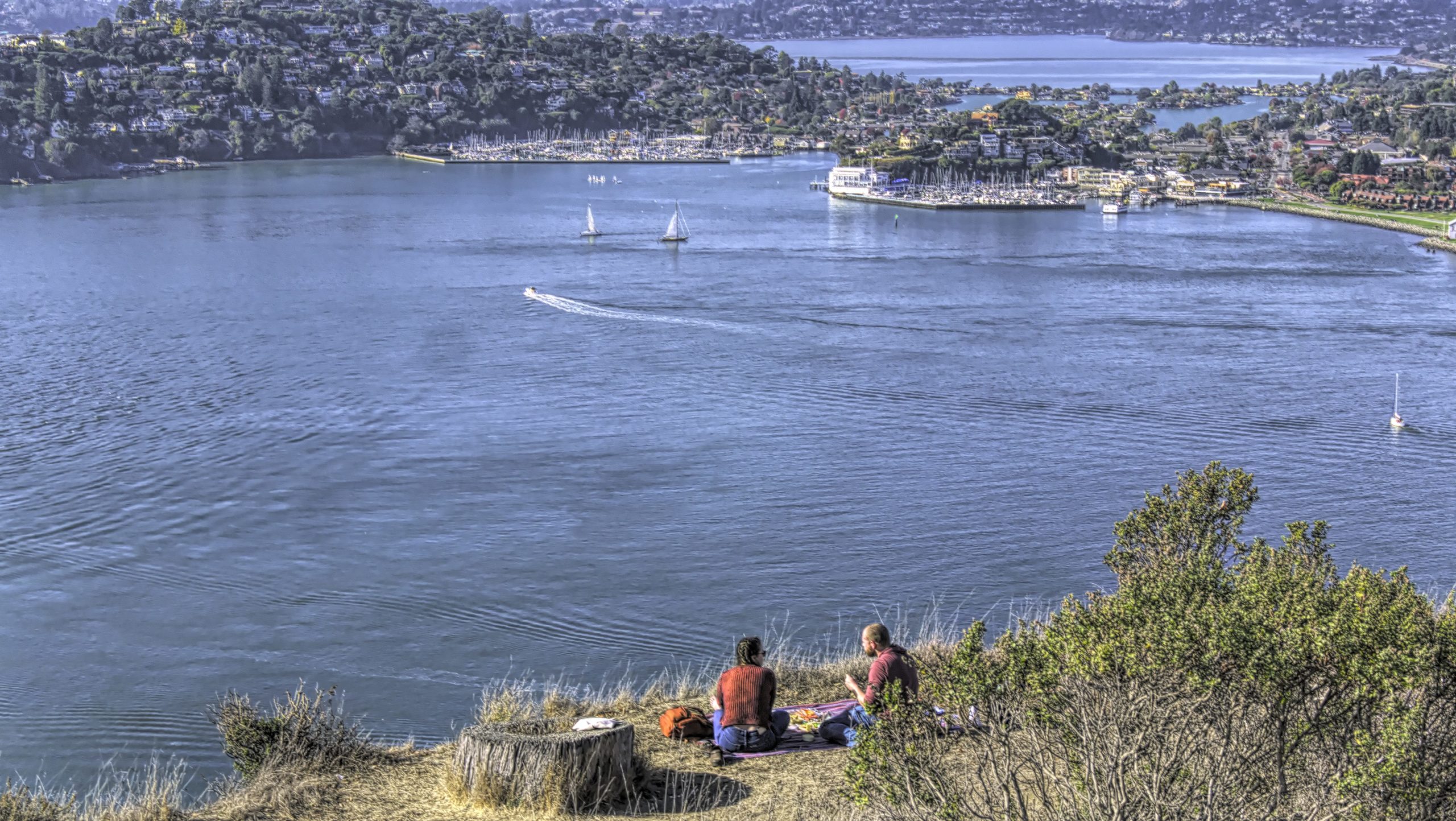
At the lower level it is fairly wooded. I like the trees that grow here. The branches twist and turn making interesting shapes. As you climb higher, you begin to be rewarded with amazing views. In the beginning you just get some glimpses of the water and scenery, but eventually the views open up to larger vistas. On this side of the island you are looking north toward the community of Tiburon and the Richmond-San Rafael Bridge. You can also see the east bay communities that are further north.


In some places as you reach the western end of a switchback, you can see west toward the Golden Gate Bridge and the Sausalito area. While you are supposed to stay on the trail, one couple found a place to picnic with pretty sweet views.


After following this narrow trail for quite a ways, you come to a wider road. To your right there is a sign that points to Mt. Livermore. We continued on up another narrow trail from this point. Initially it looks like it might be steep, but the trail continues with the switchbacks so it remains a fairly gentle upward trend.
Eventually you will come to a part of the mountain which is a field. The Golden Gate Bridge and parts of San Francisco come into view. Continuing on you will come to a crossroad with three choices. One trail goes steeply up to the top on your left. One turns toward the right, and one continues straight. We chose the steep trail to the top, and it is steep. I took it slowly, but it was a challenge. Later I realized that if we had continued straight, we would have come to a much less steep trail that would have taken us to the top so I would recommend going straight at the junction.

Once you are at the top, the views are 360 degrees in all directions. You can see to San Francisco and the Bay Bridge as well as all the other areas you have had brief peeks at as you climbed up. There are picnic tables here in a couple of locations. After your last climb you will probably want to relax a bit. The only challenge here is there is no shade. On a sunny, beautiful day like we had, there is no escaping the sun at the top.


Since we found the other way to climb up the hill, we followed it down and found the Northridge Trail. This trail goes off in a different direction so we decided to follow it down rather than return the way we came.
At the beginning of this trail it goes through a field with no trees, but eventually you come to the trees. There are some pines and then the nice twisty trees that are so fun to walk through. This part of the trail travels around the east side of the island which is the area with the most history. There was a fort on this part of the island at one point. An immigration center was also here for some time. We could look down on those buildings from the trail, but we were too high up to actually visit them. My daughter said there were some interesting places to visit as she saw them on her bike ride. Maybe another time we can see that part of the island.


The trail on this side is wider than the Sunset Trail, but the views are much less spectacular. There are no sweeping views, just occasional peeks of the water nearby or the east bay communities. For sheer beauty the Sunset Trail is better, but the Northridge Trail is wider and a little easier to navigate.


We came to a wide road, and it took us a moment or two to find the trail on the other side. It was off to the left just a little bit. Hiking lower we came to another wide road which is where the trail seems to start. From here there is a series of steep steps that lead back down to the dock area. The risers on the steps can be uneven and at times quite high. This was actually a bit of a challenge to navigate. Coming up the steps at the beginning of this walk might also be a challenge.


We arrived back at the dock area after about three hours of hiking. Having covered a good share of the island, we were exhausted. However we were not expecting the ferry to leave for another hour. The cafe was closing at 3:00 just as we came down, but we managed to grab some ice cream bars before they closed up completely. Less than ten minutes later we noticed that everyone was moving towards the dock. It turns out there was another ferry an hour earlier. We weren’t expecting that, but we decided we would take it and were the last ones on board.

On the way back, the boat stopped at Tiburon, and then we were off to the dock in San Francisco. This time we walked back to the BART entrance stopping along the way for empanadas. It had been a sunny, beautiful day for us, and we had enjoyed our day.


Angel Island is a great place to spend a day. Whether you hike to the top of Mt. Livermore or ride a bike around the perimeter, you will find some scenic and beautiful sights. The important thing is to check the ferry schedule to see when the ferry leaves, especially its final return to San Francisco. If it’s easier you can also get there on a ferry from Tiburon. Just make sure you aren’t stranded on the island. That would really make a day of it.
Have you hiked or biked Angel Island? What was your favorite part of the trip? Share in the comment section below. I’d love to hear from you.
Discover more from Battered Suitcase
Subscribe to get the latest posts sent to your email.
Awesome. Have been to San Francisco several times. My great-grandma and great-aunt lived in San Rafael. And yet, I have never heard about Angel Island. Looks great! Yet another place to add to my bucket list. Jeff
I hope you get a chance to go.