A fellow blogger Mike in his travel blog often talks about the value of just wandering in a city with no particular plan. This was about to happen to us. After realizing we were not going to go up in the Palm Springs Tram, we cast about for a way to spend out final day in Palm Springs. We ended up wandering through the nearby mountains traveling what is known as the Palms to Pines scenic byway.
It had never been our intention to drive this route. However, I had read about a great viewpoint at the beginning of the route that I wanted to check out. Once there we decided to just keep driving and ended up doing the whole route. It turned out to be an unexpected fun part of our trip.
The Palms to Pines Highway begins in nearby Palm Desert. I first tried to get to the viewpoint Friday evening. I thought it would be cool to see the lights of the valley. By the time we got to the highway, it had begun to get dark. It turned out that the beginning of the route is a series of hairpin turns. and driving it in the dark was very nerve racking. I drove part way up, but became so anxious I pulled off and turned back around. I would feel much more comfortable driving this road in the daylight.
So Saturday morning we went back to the beginning of the route which is Highway 73. This time I could see the hairpins coming and was able to maneuver up the hill. It is a pretty steep drive. I finally reached the viewpoint, and it did not disappoint. We could see a long ways out into the Coachella Valley. However, it was almost more interesting just looking down and seeing the cars that were zipping around the hairpin curves we had just maneuvered.


As we left the viewpoint, the road began to straighten out some and became less intense to drive. The scenery around also began to change to more brush and low trees.
Soon we came to a turn off on the left where there is an information center regarding the life of the Cahuilla native peoples. It’s called the Cahuilla Tewanet Vista Point. There is a short walk with some informative signs that indicate how these native people survived in this environment. It’s not something that will take a long time, but it does give a sense of the kinds of adaptations that were made by these people to survive in this region. There are also some nice vistas of the nearby mountains and canyons.


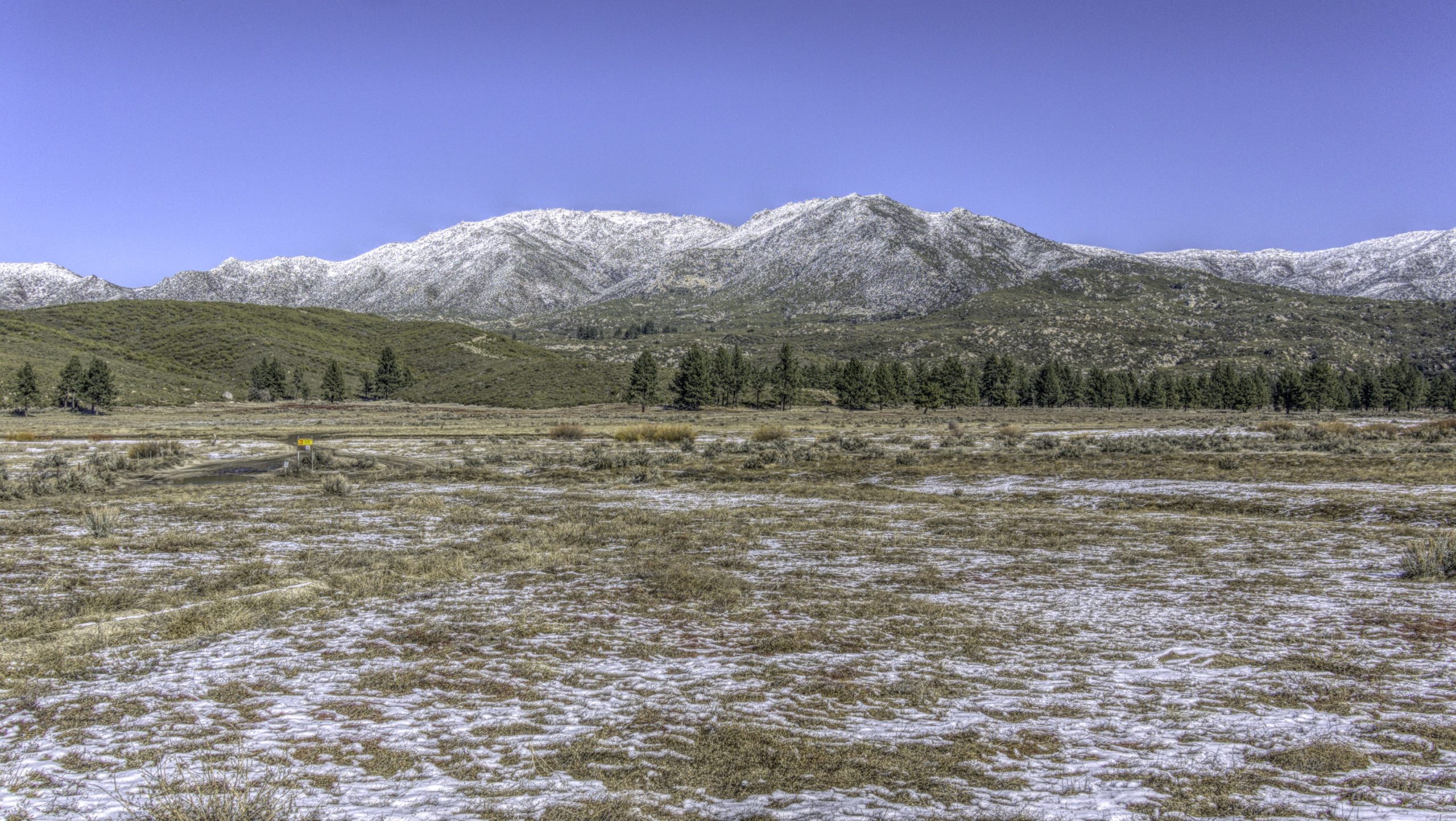
As we continued on the Palms to Pines route, we began to see snow here and there, and it only increased as we traveled further up. The road does come to a crossroads, but staying on Highway 74 kept us on track. Pretty soon we were encountering some beautiful snow covered mountains. There were homes here and some wide open spaces. The snow added an extra dimension as well as some anxiety about stopping to take a photo, but we finally found a spot to pull off the road. Here one can definitely see the pines that the drive refers to.


A short drive further down the road, and we reached Lake Hemet. It is a little confusing to get to a spot on the lake as the front part of it is a private resort. We followed a road quite a ways beside this resort before coming to a public picnic area where we could stop and check out the lake.


Shortly after Lake Hemet we came to the crossroads at Mountain Center. Here we turned onto Highway 243. As we continued on the Palms to Pines Byway we encountered more snow. In places along the side of the road we saw families and kids sledding and enjoying the snow. Some spots had quite a few people and seemed to be known places for snow activities.
We eventually reached the largest town on the route, Idyllwild. It looked like an interesting town, and normally we would have stopped and wandered around to see what it had to offer. Unfortunately, because of the snow parking was impossible. We saw cars parked wherever they could find a clear spot, and people were everywhere. I didn’t want to get caught up in the chaos looking for a parking spot so we drove on. We’ll keep this in mind for next time.
At this point the snow was pretty abundant, and cars were parked along the side of the road as families tried to get out and enjoy the snow.


After leaving Idyllwild we began to gradually descend. Our next stop was Indian Vista Point where we could look out over the western valley. There is quite a bit of parking here although the snow did limit it some when we were there. This viewpoint turned out to be our final opportunity to really see the sweeping western views.


On its final descent the road reverts to switchbacks. However, that didn’t stop people from coming up and finding a place to play in the snow. Even at lower elevations people found their spot.

The Palms to Pines Highway ends in Banning. From there we got onto Highway 10 which took us back to Palm Springs. Being wintertime, out trip over the scenic route was obviously different than at other times of year. I don’t know how often it snows here in the mountains, but for us it was a fun way to spend our final day in Palm Springs, and was something totally unexpected. We had come for the sun and ended up enjoying the snow. Who knew?
Have you traveled the Palms to Pines Byway? Perhaps you drove it in a different season. Share your experience in the comment section below. I’d love to know about your trip.
Have you subscribed to Battered Suitcase? If not why not subscribe today? Each Wednesday you will receive an email with the latest post. That’s all. Nothing else. So give it a try and sign up today.
Discover more from Battered Suitcase
Subscribe to get the latest posts sent to your email.
My brother and family lived in Idylwild. They built 2 homes there. The children had to drive to Hemet for high school, a somewhat dangerous windy road so they moved to Hemet, but now the children got jobs in Idylwild so still drove the windy road. I am sorry we never took that road. It looks beautiful in its own rugged way. Thanks for sharing it.
Thanks, Les, for your comment. I think the road would be particularly difficult with more snow and ice on the road, but it was clear for us.