We woke up on Monday to grey skies in Seward, Alaska. It was a bit of a disappointment after the fabulous blue skies of yesterday, but blue skies don’t last forever. We would make the most of this day no matter the weather. Our plan was to drive back to Anchorage, our last stop on this sojourn.
Before we left Seward, however, we planned to visit Exit Glacier which was the basis for the name of our accommodation, Exit Glacier Lodge. The glacier was about eight miles down the road from our hotel and is part of the Kenai Fjords National Park. When we arrived at the parking lot, it was pretty busy as this is a fairly easy hike to see a glacier.

Fighting off the mosquitoes as we went, we climbed up the hillside to get a closer view of the glacier. Along the way we saw some signs. One said 1926. The next said 1951. We weren’t sure what they meant. I guessed that they were elevation markers. I was wrong. It turns out the markers indicate the edge of the glacier in that particular year. Since I was born in 1951, that marker indicated where the glacier reached seventy years ago. I would say it was about three fourths of a mile to the current edge of the glacier. It was sad to realize how much it has shrunk. Later, as we drove out of the park, we saw more markers indicating the glacier had stretched beyond the edge of the current parking lot.
The hike up was not particularly difficult. However, I was using my trekking poles together for the first time. I found it gave me a little more confidence as I moved about and helped give me a boost when I was going up a particularly high step.
There are a couple of viewpoints of the glacier. Like the glacier we saw on the previous day, there was a definite blue tinge to the glacier. Below the glacier was a raging river that was flowing very fast downstream. After taking photos up above, we walked down into the river bed. This is really the area where the glacier had carved out the valley leaving rocks and silt behind. It was a very wide area, but from here we could better see the front of the glacier.


Back at the park entrance we were invited to hear a ranger talk so we did. The topic was unexpected. It was about mycorhizal fungi that live in the soil and their relationship with the trees and other plants. These fungi were something I was unfamiliar with, and the talk was actually quite interesting. It seems that plants do communicate with each other at some level, and these fungi are a major part of that process.
Feeling smarter, it was time to head out of town. We were returning to Anchorage the same way that we had come. After stopping for one more view of the glacier across Resurrection River, we continued through the Kenai region to Turnagain Arm. The clouds were really low this day covering the mountain peaks. While we enjoyed the scenery, it somehow didn’t seem as specatcular as when we drove over. Maybe we had become numb to the beauty of mountains and snow. I don’t know.


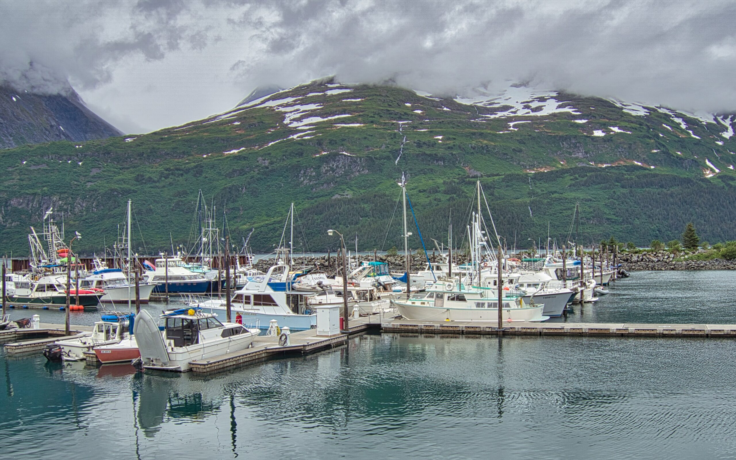
We did take one side detour to the town of Whittier. I read that there was a ferry from here that went to other towns along the southern coast so I was expecting a busy little town. The reality was much different.
First, however, we went through a most unusual experience. As we were approaching Whittier, we saw a big sign about rates. For cars the rate is $13. We were a little puzzled by this. What was this for? I was thinking maybe it was ferry rates, but it turned out that this was the rate to get into town. To enter Whittier one has to go through a one lane tunnel that is also used by the railroads. Traffic alternates on the half hour. Inbound traffic goes on the half hour while outbound goes at the top of the hour. The tunnel is the longest highway tunnel in North America at 2.5 miles long. It feels small by comparison to most tunnels since it is only one lane wide and fairly dark inside. We didn’t have to wait too long, and then we headed through the tunnel.


Getting into the town by a tunnel is not the only unusual thing about Whittier. It turns out that most people here live in the same building. The population of Whittier is only about 200 people. When we were visiting, there was a very tall building against the mountain that stood out above everything else. it turns out this is the place where most residents live. The Begich Towers Condominium was built for military purpose during World War II. After the military abandoned it, it became the home to the majority of residents. It’s not just homes here either. The mayor’s office, post office, hospital, a church, a general store, and other services and businesses are housed here as well so that residents don’t need to leave it, particularly in winter’s cold weather. This has earned Whittier the nickname “town under one roof.”
We did not explore this building but just saw it from a distance. The part we did see were the small businesses down by the water front. Sadly this area seems a little run down. There was definitely more of a fishing vibe to the town. Boats were going in and out of the water, and the boats looked ready to go fishing. It was quite a different feel than what we had in Seward.


Disappointed in what we found here, we didn’t really stay long. We wanted something to eat, but Whittier’s restaurants seemed to focus on seafood, and we are not seafood lovers. After finally getting some coffee and a snack, we decided to head on towards Anchorage sooner rather than later. Back we went through the narrow tunnel.
On the other side of the tunnel we stopped for a bit at Portage Lake. There is also a glacier nearby that one can hike up to called Portage Glacier. Having hiked to the Exit Glacier that morning, we decided not to do another hike here. Visitors can also take a tour on the lake that will take you to the face of the glacier since the lake is a result of the melting glacier. We saw the boat, but again chose not to take the cruise. Instead we continued on to Anchorage, our hotel, and a nice Italian restaurant which satisfied our hunger quite nicely.


We were discovering that Alaska has so much beauty. The mountains, water, glaciers, and even the weather has created so many scenic vistas. We were looking forward to seeing what the last few days would reveal to us.
I hope you have been enjoying reading about our journey through Alaska. Be sure to share your thoughts about this beautiful state in the comment section below. Also why not share this with a friend who might enjoy reading about Alaska? It may be just what they need.
Discover more from Battered Suitcase
Subscribe to get the latest posts sent to your email.
That tunnel looks like something from a movie set!
Yes, it was a little strange. The photos may contribute to that feeling. Thanks for commenting.