Having spent an afternoon in Bryce Canyon National Park, we were ready to see what more the park had to offer. The weather was about the same as the day before so we were looking forward to a good day. First, however, we needed to get some breakfast as our motel did not provide any.
We stopped at a cafe in the town of Panguitch. We were able to get a table, but the place was pretty busy. Our waitress was quick to take our order, but then we waited. First we waited for our coffee which never seemed to come. Then we waited for our food. We saw people who had come in after us get their food. Our waitress kept apologizing. I’m not sure all the issues, but we were there well over an hour, but we did eventually get fed.
SIlvette really wanted to take the hike down into the Amphitheater of Bryce Canyon. It is only a 1.3 mile hike. However, it’s more of an up and down hike. I initially did not want to go, but I felt it would not be good for Silvette to go alone, so I grabbed my walking sticks and agreed to go with her.
Because it was a Saturday, we knew the park would be busy. After some debate we decided to take the shuttle bus into the park to start our hike. We figured there would be no place to park as Sunset is the most popular area of the park.
Hikers can start the Navajo Loop Trail from either end. One side is called Wall Street, and the other side is called the Two Bridges. There are pros and cons to either way, but we decided to go the Two Bridges route. Quite a few people start down the trail to where the loop diverges, but after that only those who are actually hiking continue down into Bryce Canyon.
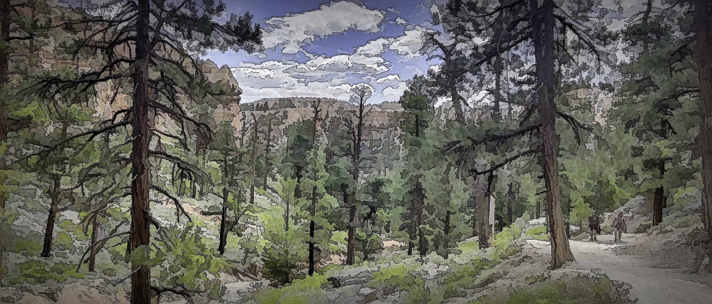
The first part of the trail didn’t seem too bad. It was a gradual decline, and it was inspiring to look around at the hoodoos towering above us. The trail is a hard compact earth with some gravel here and there. It wasn’t the easiest to walk on as it wasn’t completely level. There were bumps and ridges in the trail that could trip one up if they weren’t careful. There are also no guard rails along the edges so we tried to stay away from the edges as much as possible.


After a while we came to a series of switchbacks that went down pretty quickly. We could see down to the bottom, and it seemed a long ways down. We could also see the hikers coming up the trail. During our hike the sun would sometimes disappear behind a cloud, and that was always a time of relief as it was pretty hot when it was shining right on us. We were hiking pretty much in midday sun so there were few shadows to provide shade.
At the bottom of the switchbacks, we went through a narrower canyon section. Here the two bridges were noted. They were small narrow bridges connecting two cliffs. They weren’t that exciting.


We thought we were at the bottom of the canyon, but we continued to go down although it was much more gradual. The area also opened up, and we found ourselves looking at more and more trees. It was really rather a pleasant location inside Bryce Canyon.


Eventually we reached a turning point. A number of trail options were available, but we just kept going on the Navajo Loop. Now it began to climb. Initially we were still seeing quite a few trees, but we were also looking up to the tops of the canyon walls.


We came to a narrowing of the trail and climbed some stairs that had been put in to make the climb easier. The stairs opened into an almost-cave section that had just a sliver of an opening at the top.


Then came the switchbacks going up. They turned out to be not as difficult as I had anticipated. In one section the switchbacks were very short. It seemed like only five or six steps, and one would turn the corner. This part of the trail was much dustier for some reason which made it a little more slippery. I did see one woman fall as she was going down. I was glad we were going up.


We finally reached the top. It had taken us an hour and 40 minutes to hike the 1.3 miles inside Bryce Canyon. Not exactly a fast pace, but we really applied the saying, “slow and steady,” and it seemed to work out.

After our successful hike we caught the shuttle to take us back to our car. Our day wasn’t over, however. We needed the car to finish our experience in Bryce Canyon. An 18 mile drive takes visitors beyond the amphitheater and out into other parts of the park. The shuttle doesn’t go to these other locations so we needed our car to get there. It also didn’t stop at the entrance sign so now we could get our photo of the sign.
The first thing we did on the drive was stop at a picnic spot and have a bite to eat. Despite our late and full breakfast, the hike had made us hungry again. Then it was on to a series of stops much like we had done in the Grand Canyon a few days before.
Our first stop was Sheep Creek/Swamp Canyon trail connector. Here we saw some tall cliffs of hoodoos. However, the more interesting thing for me were two birds (ravens?) who were sitting together in a tree. Because of the light they were mostly in silhouette so it was hard to identify them. One bird was actively touching the other bird with its beak as if caressing it. The second bird’s feathers were somewhat ruffled out. They sat there for quite some time so it was fascinating to watch.


Our next stop was Farview Point. On the left side was a tall cliff which was white on top. In the center was a flat top formation. Looking to the right were a number of hoodoos at various levels. It was here that I looked out and could see some rain clouds in the distance. They were dark which made an interesting contrast to the nearer sunlit cliffs.


A sign pointed us to a nearby viewpoint called Piracy Point. Here we could look back to the cliffs below Farview Point. We could also look down and see almost step like formations of the rocks with trees growing on them. In the distance we saw forests with the shadows of the clouds spreading over them.


We returned to the parking lot of Farview Point. It has a pretty large parking lot, and one unexpected feature here is a food truck. There were picnic tables near the truck, and quite a few people were taking advantage of the food. The sign I saw indicated he sold sandwiches. The one negative was he used a generator, and it was a somewhat noisy disruption of nature.

A natural bridge was the next stop in our drive. In reality it seemed more a window as a lot of rock was still over the opening. The circular feature was pretty much all there was to see here. A few other rock formations did stick out.


Agua Canyon was the next stop about a mile down the road. There was an interesting rock formation here that looked like a head to me. We also had views of other hoodoos in the area. To be honest, by this point we began to feel like these viewpoints all began to look alike. The cliffs and formations were all similar. While we thought they were beautiful and amazing sights, they began to lose their ability to put us in awe.


We skipped a couple of stops at this point and headed to the end of the road which is Rainbow Point. This is the highest point in the park with the views to show it. This area had a number of pit toilets as well as a covered viewing area so it was more of a destination point. The views were grand, but we were also noting that the dark rain clouds were getting closer and added more drama to the landscape.


A short walk away was Yovimpa Point. This viewpoint looked off into a different direction than the other viewpoints. Nevertheless it was still a view of the cliffs and hoodoos we had seen before. The new experience here was the rain caught up with us. It was not a heavy rain, but it was definitely rain, not a mist. We got caught in it, but it actually felt refreshing, and we didn’t get that wet.


Turning around and heading back to the park’s entrance, we stopped at the two points we had skipped on the way up. Black Birch Canyon and Ponderosa Canyon offered more views of the cliffs and hoodoos. The brief rain we had experienced was already gone, and the skies were much brighter.


We then drove back through the park and headed to our motel. Dinner was at a Mexican restaurant. Following that I did laundry at the laundry facility of an RV park just across the street from our motel.
Tomorrow we would head off in search of more adventures in Utah. I hope you’ll join me next week. One way to guarantee that is to sign up below for my weekly post to be delivered to your inbox. It’s safe and easy to do.
Discover more from Battered Suitcase
Subscribe to get the latest posts sent to your email.
We loved Bruce when we went in 2008. Great memories of doing that loop trail ending with the big switchbacks. Kiri would have been 18 and I recall celebrating Emma’s 8th birthday at our campsite between Bryce and Zion.
I think Bryce is one of the more unique national parks. I’m surprised it’s not more popular. Thanks for sharing your memories.